

India’s Himalayan Surveillance Network Expands Near the China Border
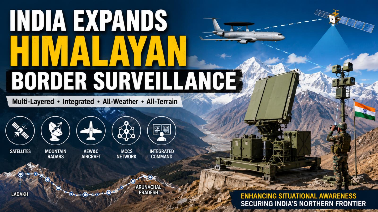
India is strengthening high-altitude surveillance from Ladakh to Arunachal Pradesh through mountain radars, airborne warning platforms, satellite imagery, and integrated command networks. The effort aims to close terrain-driven detection gaps along the Line of Actual Control.Why India Is Strengthening Detection Along the LAC
India’s Himalayan surveillance network is gradually taking shape across the country’s northern and northeastern frontier, where difficult terrain creates major challenges for detecting aircraft, drones, and low-flying threats.
Defence reports describe an interconnected surveillance architecture stretching from Ladakh to Arunachal Pradesh. However, the government has not publicly announced it as a formally named project. Official confirmation currently covers individual radar purchases, indigenous surveillance systems, and command-network upgrades.
How India’s Himalayan Surveillance Network Is Taking Shape
New Delhi, July 22, 2026: India is strengthening its monitoring capabilities along the Line of Actual Control through a combination of mountain radars, airborne early-warning aircraft, radar-imaging satellites, and digital command networks.
The shift gained urgency after the June 2020 Galwan Valley clash and China’s continuing expansion of military infrastructure across Tibet and Xinjiang. Airbases, drone facilities, hardened shelters and air-defence installations across the Tibetan Plateau have increased the need for continuous monitoring on the Indian side.
Mountainous terrain presents a particular challenge. High ridges and deep valleys can block conventional radar signals, creating gaps that may be exploited by helicopters, drones, cruise missiles, or aircraft flying at low altitudes.
Mountain Radars Target High-Altitude Detection Gaps
On March 31, 2026, the Ministry of Defence signed a contract worth approximately ₹1,950 crore with Bharat Electronics Limited for two indigenous Mountain Radars for the Indian Air Force.
The systems were designed by the Electronics and Radar Development Establishment under the Defence Research and Development Organisation. BEL will manufacture the radars and provide associated equipment and infrastructure. The ministry said their installation would strengthen air defence and reduce dependence on imported equipment.
Media reports indicate that the systems could be deployed in the Gulmarg region of Jammu and Kashmir and near Pfütsero in Nagaland. The government’s official announcement, however, did not disclose its planned locations.
These radars are expected to improve surveillance over vulnerable sections of the western and eastern Himalayan frontier.
Indigenous Radars Add Multiple Detection Layers
India already operates several indigenous radar systems designed for different ranges and terrain conditions.
The Arudhra Medium Power Radar is a mobile phased-array system developed for long-range aerial surveillance. DRDO documents describe it as capable of detecting and tracking aerial targets while operating in challenging electronic-warfare environments.
The Ashwini Low-Level Transportable Radar uses an active phased-array design to detect targets ranging from fighter aircraft to slower-moving aerial platforms. Its mobile configuration allows it to be repositioned according to operational requirements.
Smaller systems provide coverage closer to the ground. DRDO’s Bharani radar is designed for mountainous terrain and can detect drones, helicopters, and fixed-wing aircraft at low and medium altitudes. The Aslesha system can also be deployed on mountain tops and in high-altitude regions to track helicopters, fighters, and unmanned aerial vehicles.
Satellites and Airborne Platforms Extend Coverage
Radar-imaging satellites provide another important surveillance layer. ISRO’s RISAT systems use Synthetic Aperture Radar technology, allowing them to capture images during both day and night and under difficult weather conditions.
EOS-04 was similarly designed to provide high-quality radar imagery under all-weather conditions. Publicly available ISRO descriptions focus mainly on Earth-observation applications, although radar imagery can support broader situational-awareness requirements.
Airborne Early Warning and Control aircraft complement satellites and ground radars by operating above mountain barriers. India’s indigenous AEW&C platform provides surveillance, communication, and electronic-warfare capabilities, enabling it to detect and track aerial activity across wider areas.
IACCS Connects the Surveillance Network
The Integrated Air Command and Control System, or IACCS, is central to combining inputs from different sensors.
The system is intended to help generate a common air-situation picture by linking radar stations, airborne sensors, and air-defence commands. Official defence capability documents also call for new surveillance systems to share fused tracking information with IACCS.
By connecting mountain radars, mobile sensors, airborne platforms, and satellite-derived information, India aims to detect threats earlier and reduce the time required for commanders to coordinate a response.
The emerging architecture reflects a wider transition towards network-centred warfare. Rather than depending on one radar or aircraft, India is creating overlapping surveillance layers that can continue operating even when terrain, weather or electronic interference limits an individual system.